
VOLUNTEERING - MAPPING FENCES FOR MIGRATION
By Kathy Lichtendahl
Fences are as much a part of the modern west as is the cowboy. They are used to contain stock and to delineate property boundaries. They are so ubiquitous that we often drive by miles of wire strung between posts along highways across the state without giving a thought to what it means to wildlife trying to make its way up the slopes to greener pastures in the spring or down hills to avoid deep snows in the winter.
The Absaroka Fence Initiative (AFI) formed in the Big Horn Basin in 2020. A collaboration between several state and federal agencies, NGO’s, and private land owners, the goal of the organization is to make fencing more wildlife friendly while still satisfying the needs of ranchers to contain livestock. In 2021, AFI held field days that resulted in the removal of 8.2 miles of obsolete fence and the modification of 5.7 miles of fence to make it friendlier to wildlife.
In addition to continuing fence modification and removal, AFI is working with the Wyoming Migration Initiative under the guidance of Emily Reed to inventory fences that cross known and suspected migra-tion corridors within the Big Horn Basin. The knowledge collected will allow the organization to target specific problem areas for improvement.
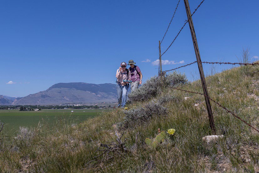
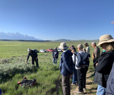
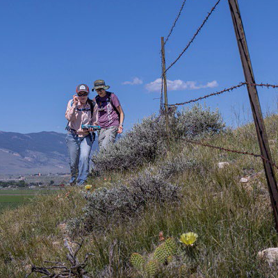
A few weeks ago I was part of a training field day on a ranch north of Cody in which we practiced using the equipment and software required to accurately map the location and condition of fences throughout the region. Fences are notoriously difficult to survey from the air so the only surefire way to record their existence is by boots on the ground. We were divided into teams of three to four people; each group in possession of a GPS and a tablet preloaded with the software containing the questions that were to be an-swered. Starting at a location supplied to us by the group leader, we walked the fence line, recording data such as fence type, number of wires, existence of gates, animal tracks, carcasses, and many other facts, all noted with corresponding coordinates ac-cording to the GPS.
Field days are planned to take place regularly throughout the sum-mer months. I look forward to continuing to help gather the critical information that will allow AFI to propose and implement improvements to fencing throughout migra-tion corridors in the Big Horn Basin.
VOLUNTEER OPPORTUNITIES
National Elk Refuge opportunities
Limited Housing or an RV site may be availa-ble with volunteer positions. An RV pad with electrical, water, and sewer is provided in ex-change for work hours 48/couple or 32/indi-vidual per week. Laundry facilities provided on site. Wi-Fi is available at certain RV sites. All pets must be pre-approved by the Volunteer Coordinator prior to arrival. Local volunteers who do not need housing, have no minimum work hours per week.
For volunteer opportunities on the National Elk Refuge con-tact the volunteer coordinator Annie Sorrell. Email: annie_sor-rell@fws.gov
Check out all our WNP volunteer opportunities! They are listed on the WNP website here. Remember when you visit the list you can filter it by region or type of project, and it’s not an exhaustive list.
If you are in the Laramie area there is a fence removal project on the morning of August 6th. Contact Common Outdoor Ground (included in the list) for more info.
OUT AND ABOUT
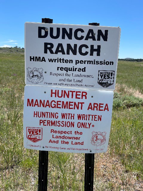
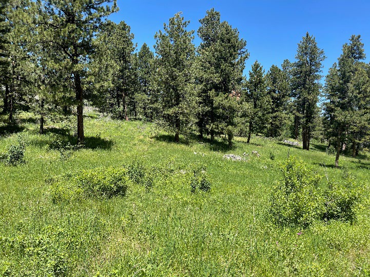
Duncan Ranch Site Visit
By Dan Bach, Steering Committee Member
I was so impressed with the area. I don’t recall being in a place where the ponderosa pine trees had never been cut down. The area is pristine, and I would highly recommend a day visit to this part of the Laramie Range if you have never been there. There are walking, biking and eques-trian trails throughout the area.
Allow me to “cut and paste” from my report. Ignore the “dryness of the technical writing.”
The Duncan Ranch Hunting Management Area is located on the northern edge of the Laramie Moun-tains and is composed of granite gneiss (Love and Christensen 1985). Outcrops are numerous on the ridges and slopes in the area that have little potential of soil deposition. The topography ranges from gradual to rugged and the slopes are gradual to steep ranging from near flat to 20 percent. Collu-vium deposition is present along the banks of Batts Creek. According to USDA Natural Resources Con-servation Services (2022), there are two outcrop types: Cathedral-Rock outcrop complex, wooded, 6 to 75% slopes, and Rock outcrop – Cathedral com-plex, 10 to 75% slopes.
Okay, so yes, that was dry reading, but it does give you a good back-ground. That said, here is the link to the folder with all of my pic-tures. While I was there I also ob-served robins (Turdus migratorius) and I could hear a wood pecker but I never saw him or her. Sorry I haven’t had time to rename the files with the name of the plants or insects. That might make for a good winter project.
Social Media
ADVANCED TRAININGS
- Bird Walk, July 30, Wyoming Territorial Prison State Park, Laramie. Two-hour walk with Zach Hutchinson along the Laramie River, starting at 8:30 am.
- Wildlife Diseases, July 30, 11 am, Laramie Regional Game and Fish Office, 1212 S. Adams St., Laramie. Two-hour interactive workshop on wildlife diseases taught by Jessica Jennings, Wyoming Game and Fish Department veterinary scientist.